Missouri (river) - Geography.
Publié le 03/05/2013
Extrait du document

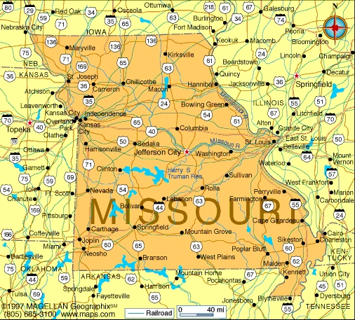
Missouri (river) - Geography. Missouri (river) (Illinois Emissourita, "dwellers of the big muddy"), river in central United States. The Missouri is formed by the confluence of the Jefferson, Gallatin, and Madison rivers at Three Forks in southwestern Montana. The longest river system in the United States, the Missouri is one of the primary tributaries of the Mississippi River. From its source, it flows 4,090 km (2,540 mi) and drains an area of about 1,370,000 sq km (about 529,000 sq mi). The Missouri initially flows north, skirting the main range of the Rocky Mountains. Then it passes through a 366-m (1200-ft) gorge called the Gates of the Mountains, turns northeast and reaches Fort Benton, Montana, the head of navigation. From Fort Benton the river flows east and is joined by the Milk River at Frazer, Montana, and by the Yellowstone River at Buford, North Dakota. From this point the Missouri flows generally southeast through North Dakota and South Dakota to Sioux City, Iowa, where it turns south and becomes the boundary between Nebraska and Kansas on the west and Iowa and Missouri on the east. The Platte River is received near Omaha, Nebraska, and the Kansas River at Kansas City, Missouri. On receiving the Kansas, the Missouri turns east and flows across the state of Missouri. About 27 km (about 17 mi) north of St. Louis, the muddy Missouri enters the channel of the Mississippi. Other important cities on the river are Bismarck, North Dakota; Council Bluffs, Iowa; Saint Joseph, Missouri; and Atchison, Leavenworth, and Kansas City, Kansas. The upper Missouri traverses mountainous terrain covered with dense coniferous forests. These forests support large animals, including bears, elk, and moose. Fish found in the cold upper river include the Montana grayling and the rainbow trout. The middle and lower river valleys are lined with grasslands and forests of poplar, hickory, and other trees, providing a habitat for rabbits, foxes, beavers, and other animals. Fish in the warmer lower river include bass, several species of catfish, and carp. Historically, a number of Native American peoples lived in the valley along the Missouri, including the Hidatsa, Crow, Iowa, Arikara, Blackfoot, and Sioux. The region was popular for buffalo hunting and agriculture, and the tribes used the river for commerce. In 1673 French-Canadian explorer Louis Joliet and French missionary and explorer Jacques Marquette became the first Europeans to discover the Missouri when they came across the lower river during a journey down the Mississippi. The lower river became an important route for fur traders, who began to venture farther up the river. During the Lewis and Clark Expedition of 1804 to 1806, American explorers Meriwether Lewis and William Clark became the first whites to explore the river basin from its mouth to its headwaters. Steamboat traffic on the Missouri began in 1819 with the voyage of the Independence, and soon steamboats were taking settlers west, as well as hauling freight such as grain, fur, lumber, and coal. Steamboat activity peaked in 1858, but then the construction of railroads lessened traffic on the river. The lower portion of the river now supports commercial barge lines which carry agricultural products, steel, and oil. In order to enhance navigability and provide flood control, hydroelectric power, and irrigation, the Missouri River Basin Program was created in 1944. Under this program and the subsequent Missouri Basin Program, a series of dams, reservoirs, and locks were built on the river. However, in 1993 heavy rains caused recordbreaking flooding along the Missouri and other branches of the Mississippi River. Microsoft ® Encarta ® 2009. © 1993-2008 Microsoft Corporation. All rights reserved.
Liens utiles
- Missouri (river) - geography.
- Missouri - geography.
- Kansas City (Missouri) - geography.
- St. Lawrence (river) - Geography. I INTRODUCTION St. Lawrence (river) (French Saint-Laurent), river
- Amazon (river) - Geography.


